The ALPINE-HIMALAYAN MOBILE BELT covers the territories of Southern Europe, North Africa, South and Southeast Asia - from the Strait of Gibraltar to Indonesia; stretches in the sublatitudinal direction for a distance of about 17 thousand km.
It is subdivided into four branches of cover-folded mountain structures. 1st - Pyrenees - Alps - Carpathians - Balkanides - Pontides - Lesser Caucasus - Elburs - Turkmen-Khorasan mountains. 2nd - Northern Dobruja Mountainous Crimea - Greater Caucasus - Kopetdag. 3rd - Apennines - Calabrids (south of the Apennine Peninsula) - structures of Northern Sicily - Tell Atlas - Er Reef Andalusian mountains (Cordillera Betika) - structures of the Balearic Islands of the Western Mediterranean. 4th - Dinarids of the Hellenids - structures of the south of the Aegean Sea - the Cretan arc - the Taurids of Turkey - Zagros - Makran - the Baluchistan mountains - the Himalayas - the Indo-Burman orogen - the Sunda-Banda arc of Indonesia. The belt began to develop during the breakup of the Pangea supercontinent in the 2nd half of the Permian, when, as a result of continental rifting and subsequent spreading in the Triassic-Jurassic, the Mesotethys ocean (see Tethys article) arose, partially inheriting the Paleozoic Paleotethys, but located south of the latter. The collision of the continents in the area of Mesotethys began in the Late Jurassic. In the Late Cretaceous, a new ocean opened to the south - Neotethys, which had many branches, bays and marginal seas. It is believed that the Alpine-Himalayan mobile belt mainly arose during the closure of this ocean. Relic basins of the Meso- and Neo-Tethys have been preserved in the Mediterranean Sea.
The closure of Neotethys began in the Paleocene and was caused by the collision of island arcs and the collision of continents and microcontinents with Eurasia. The main phase of deformations is the Late Eocene. Continental collision was accompanied by the formation of numerous covers, including ophiolite ones. The introduction of the Hindustan block into Eurasia from the south led to the formation in the eastern segment of the belt of the highest mountain ranges (Hindukush, Pamir, Himalayas). The amount of penetration is about 2 thousand km. The belt continues to develop actively (seismicity, volcanism). The modern convergence (rapprochement) of the Afro-Arabian and Eurasian plates is realized in active subduction zones (subduction of one lithospheric plate under another) of the Eastern Mediterranean (Calabrian, Aegean and Cyprus) and in the south of the Arabian Sea. In the Burman-Sonda system in the southeast of the belt, the subduction of the Indian Ocean crust under the Sunda-Banda island arc continues, in the extreme south of which, in the region of Timor Island, the collision of the Australian continent with the Eurasian continent began in the middle Pliocene.
Lit .: Hain V. E. Regional geotectonics: Alpine Mediterranean belt. M., 1984; he is. Tectonics of continents and oceans (year 2000). M., 2001.
A. F. Limonov.
Altitudinal zonality of the territory Russian Federation is diverse and closely related to latitudinal zones. With height, the soil-vegetation cover, climate, geomorphological and hydrological processes are transformed.
A change in the components of nature provokes a change in natural complexes, in the process of which altitudinal belts are formed.
The change of territorial natural complexes depending on the height is called altitudinal zonality or vertical zonality.
Factors affecting the formation of altitudinal zonality
The process of formation of different types of altitudinal zonality is influenced by the following factors:
1. The geographical location of the mountain system. The altitudinal position and number of mountain belts in a particular mountain system depends on the latitude of the territory in which they are located, as well as its position in relation to the nearest oceans and seas.
What mountains form the basis of the Alpine-Himalayan belt?
The height of the mountain belts of Russia increases in the direction from north to south.
A striking example of this theory is the high mountain system of the Urals, which is located in the northern part of the state.
The maximum height of the Ural Mountains becomes 1100 m, while for the Caucasus Mountains this figure serves as an average height indicator. Each mountain system has a different number of altitudinal belts.
2. Relief.
The distribution of snow cover, the preservation of weathering products, and the level of moisture determine the relief of mountain systems. It is the relief structure of the mountains that influences the formation of natural complexes, in particular, the vegetation cover.
3. Climate. Climatic conditions are the most important factor due to which the formation of zones of altitudinal zonality occurs. With an increase in altitude relative to sea level, there are significant changes in the level of solar radiation, temperature, strength and direction of the wind, and the general type of weather.
The climate affects the flora and fauna of mountain systems, eventually creating a certain authentic natural complex.
4. Slopes exposure. The exposition of mountain slopes plays a significant role in the distribution of moisture, heat, and weathering processes. In the northern parts of the mountain systems, the slopes are much lower than in the southern parts.
The history of the formation of altitudinal zonality in Russia
The formation of altitudinal zonality in the modern territory of the Russian Federation originates in the early Pleistocene, during the interglacial period (Valdai and Moscow icing).
Due to repeated climatic transformations, the boundaries of altitudinal zonation have shifted several times. Scientists have proven that all modern mountain systems in Russia were originally located approximately 6 ° above their current position.
The altitudinal zonality of Russia led to the formation of mountain complexes - the Urals and the mountains of the south and east of the state (the Caucasus, Altai, the Baikal mountain ranges, the Sayans).
The Ural Mountains have the status of the most ancient mountain system in the world, their formation began presumably in the Archean period. The mountain systems of the south are much younger, but due to the fact that they are closer to the equator, they significantly predominate in terms of height.
The lecture was added on 07.11.2012 at 02:47:11
Mediterranean (Alpine-Himalayan) folded (geosinklinal) belt- a folded belt that crosses Northwest Africa and Eurasia in a latitudinal direction from the Atlantic Ocean to the South China Sea, separating the southern group of ancient platforms, which until the middle of the Jurassic period constituted the Gondwana supercontinent, from the northern group, which previously constituted the Laurasia continent and the Siberian platform.
Mediterranean fold belt
In the east, the Mediterranean fold belt articulates with the western branch of the Pacific geosynclinal belt.
The Mediterranean belt covers the southern regions of Europe and the Mediterranean, the Maghreb (North-West Africa), Asia Minor, the Caucasus, the Persian mountain systems, the Pamirs, the Himalayas, Tibet, Indochina and the Indonesian islands.
In the middle and central parts of Asia, it is almost united with the Ural-Mongolian geosynclinal system, and in the west it is close to the North Atlantic system.
The belt was formed over a long period of time, covering the period from the Precambrian to the present day.
The Mediterranean geosynclinal belt includes 2 folded areas (mesozoids and alps), which are divided into systems:
Cm.
Notes
- Zeisler V.M., Karaulov V.B., Uspenskaya E.A., Chernova E.S. Fundamentals of regional geology of the USSR. - M: Nedra, 1984. - 358 p.
Links
Fold belts on the world map
CC © wikiredia.ru
The Alpine-Himalayan mountain belt begins in the southwest of Europe and stretches in a narrow strip to the east. It includes the Pyrenees, the Alps, the Carpathians, the Caucasus, the Apennines, the Balkans, as well as the plains in the internal depressions.
The continuation of the Alpine-Himalayan belt in Asia is the Asia Minor Highlands. In the north, the Pontic Range stretches in a long chain, in the south - the Taurus Mountains.
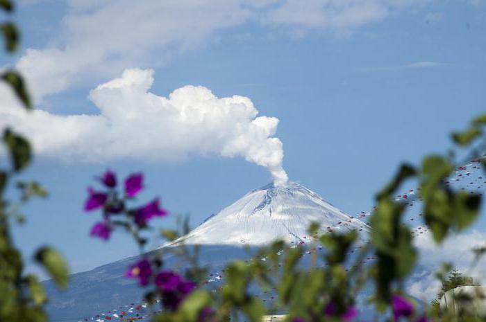
The Armenian volcanic highlands (5156 m) are located to the east of the Anatolian plateau. Here you can see volcanic plateaus, volcano cones, sinkholes and other forms of volcanic relief. In general, the Armenian Highland is a huge vault, raised and split into separate parts. The largest area of the vast Iranian Highlands (5604 m) is occupied by the Elburz Range, the Zagros Mountains and the vast plains between them. This is an active seismic zone, where earthquakes of magnitude up to 10 occur.
The mountainous countries of the Hindu Kush, the Pamirs, the Himalayas and the Tibetan Plateau are the highest on our planet. The main feature of the relief is a very deep dissection.
The thickness of the earth's crust on the border of the Himalayas and Tibet reaches 70 km, which is about 30 km more than in adjacent territories.
The Himalayas include a vast territory about 2500 km long and up to 350 km wide. Everest reaches 8848 m. The highest part of the Himalayas is composed of crystalline schists, and Everest is composed of Permian limestones.
One of the most spectacular mountain nodes on the surface of the Earth is the Pamirs. The mountain ranges of Karakoram, Kunlun, Hindu Kush converge in it. Here the highest mountains and high plateaus coexist.
Mountain ranges with sharp jagged ridges separate giant valleys 2-3 km deep.
ALPINE-HIMALAYAN MOBILE BELT
Huge glaciers and glacial lakes lie in their upper reaches. Scientists believe that these signs point to the rapid uplift of mountains (I -2 cm per year) that continues to this day. This is also reminded by frequent earthquakes, leading to large landslides and destruction of slopes. Geologists suggest that the Pamir mountain junction was created by the collision of lithospheric plates.
In the southeast, the Alpine-Himalayan belt ends with the Burmese Highlands (4149 m), composed of granites, schists, limestones and sandstones.
The submeridional ridges are separated here by longitudinal depressions. Axial zones are composed of Mesozoic granites and shales. It looks like the Shan Highlands.
Thus, the entire Alpine-Himalayan belt is characterized by dynamism and contrast. tectonic movements(in the Alps, the range of motion was 10-12 km; in the Carpathians - 6-7 km; in the Himalayas - 10-12 km).
Although volcanism did not develop in all the mountainous countries of this belt, the seismic intensity is quite high. Zones of "seismic silence" alternate with zones of frequent earthquakes with a magnitude of up to 10 points.
A year ago, on April 25, 2015, a resonant earthquake of magnitude 7.8 occurred in Nepal.
In April 2016, the main seismic events took place in the Pacific Ring of Fire in the Philippines, near Kamchatka, in Japan, near Vanuatu— April 13, 2016 , off Guatemala, in Japan, April 15, 2016, in Ecuador on April 16, 2016.
But, - April 13, 2016- there was an earthquake magnitude 6.9 — in Myanmar . This is the zone of the Alpine-Himalayan seismic belt. Forecast.
On Earth, from April to July 2016, a period of seismic turbulence begins. In seismically active regions, there are two resonant earthquakes per day, a huge number of aftershocks, subsequent shocks. The number of resonant earthquakes in a short period of time is increasing.
As stated in the earthquake forecast for April 2016:
In March 2016, under the influence of cosmic resonance factors, a large seismic energy accumulated in the Earth's geosphere. V April – May – June 2016 the accumulated seismic energy will be released in the form of resonant earthquakes and volcanic eruptions.
Trigger of Himalayan tectonics 2015. Alpine-Himalayan seismic belt.
The period of seismic calm in Southeast Asia is coming to an end, and the catastrophic earthquake that occurred in Nepal on April 25, 2015 could be the trigger for even more destructive tremors in the Himalayas, geologists say in Science News.

Experts believe that the Nepalese earthquake of magnitude 7.9 is long overdue. The section of the fault at which the epicenter of the shocks fell has been seismically stable since 1344. The source of the tremors was at a depth of 15 km, where the Indian Plate is moving under Southern Tibet at a rate of about 20 mm per year. Squeezing the plates leads to an increase in pressure, as a result, the rocks of the earth's crust do not withstand and crack.

Alpine-Himalayan seismic belt.
The tectonic plates located under the territory of Nepal have been approaching the fault point for several centuries. The shocks were too weak to release all the accumulated pressure, they only "blew off steam." Now we should expect powerful earthquakes, however, scientists do not know the exact dates.
A source

Activity in the Alpine-Himalayan seismic belt at the end of April 2016.
This seismic activity in the region determines the high probability of a resonant earthquake with a magnitude of more than 7.0 - in late April, early May 2016.
Resonant dates of seismic activity at the end of April 2016.
Since March 2016, a seismic resonance has been operating - a factor in the emerging Jupiter-Saturn quadrature.
Cosmological correspondence - resonant earthquakes with a magnitude of more than 7.0, resonant tsunamis, resonant eruption of active volcanoes.
The period of validity of the exact and wide quadrature Jupiter - Saturn - March - July 2016.
Mars reversal near Saturn - April 17, 2016 - seismic resonance - factor.
Mars in a turn in reverse motion from April 15 to 20, 2016 on the Aldebaran-Antares catastrophe axis - seismic resonance - a factor.
Pluto reversal - April 18, 2016 - seismic resonance - factor.
Conjunction Moon, Jupiter in square to the conjunction Mars, Saturn - April 18, 2016 - seismic resonance - factor.
Tau-square Moon - Pluto - Venus, Uranus - April 20, 2016 - seismic resonance - factor.
Conjunction Mars, Moon, Saturn in square to Jupiter, in square to Neptune - April 25, 2016 - seismic resonance - factor.
Mercury reversal in reverse motion - April 28, 2016 - seismic resonance - a factor.
Ingression, the transition of Venus into the sign of Taurus - April 30, 2016 - seismic resonance - a factor.
Jupiter reversal into direct motion in square to Saturn - May 9, 2016 - seismic resonance - factor + - 14 days.
Studies of the connections of seismic activity, volcanic activity, intense manifestation of the Elements with Cosmic factors, gravitational fields of planets, activity of the Sun, torsion fields and rays of Near and Far Space - Fixed Stars, Nebulae - Galaxies - are conducted in the method "Cosmology - Astrology as a security system". Software- astroprocessor ZET GEO.
Andrey Andreev - cosmo-rhythmologist.

Forecast of earthquakes, seismic activity for 2016. Regions of seismic activity 2016.
Earthquake forecast for April 2016.

Earth crystal lattice.
A folded belt that crosses Northwest Africa and Eurasia in a latitudinal direction from the Atlantic Ocean to the South China Sea, separating the southern group of ancient platforms, which until the middle of the Jurassic period constituted the Gondwana supercontinent, from the northern group, which previously constituted the Laurasia continent and the Siberian platform. In the east, the Mediterranean fold belt articulates with the western branch of the Pacific geosynclinal belt.
The Mediterranean belt covers the southern regions of Europe and the Mediterranean, the Maghreb (North-West Africa), Asia Minor, the Caucasus, the Persian mountain systems, the Pamirs, the Himalayas, Tibet, Indochina and the Indonesian islands. In the middle and central parts of Asia, it is almost united with the Ural-Mongolian geosynclinal system, and in the west it is close to the North Atlantic system.
- Mesozoids -
- Indo-Sinian (Tibeto-Malay);
- West Turkmen (Nebitdag);
- Alpides -
- Caucasian;
- Crimean;
- Balkan;
- Central European;
- Apennine;
- North Magribskaya;
- Iranian-Omani;
- Kopetdago-Elbursk;
- Baluchistan;
- Afghan-Tajik;
- Pamir;
- Himalayan;
- Irrawaddy;
- West Malay
Notes
Links
TOPIC 3GENERAL FEATURES OF THE GEOLOGICAL STRUCTURE OF THE AREAS OF THE ALPINE FOLDING (GEOLOGY OF THE GREATER CAUCASUS, THE FOLDED REGION OF THE EASTERN CARPATHIANS AND MOUNTAIN CRIMEA)
Task 4 Scheme of the structures of the Alpine folded region of the Greater Caucasus
Target: draw a diagram of the structures of the folded region of the Greater Caucasus
Work plan:
1 Legend to the scheme of structures of the Greater Caucasus
2 Border of the Greater Caucasus
3 Main structural elements of the Greater Caucasus
Materials:
- Literature: Koronovsky N.V.
A short course in regional geology of the USSR. – Ed. Moscow University, 1984. - 334 p., Lazko E.M. Regional geology of the USSR. Volume 1, European part and Caucasus. - M.: Nedra, 1975.
– 333 pp., lecture notes on the geology of the East European Platform.
Basic concepts for the task
In the north, the boundary between the meganticlinorium of the Greater Caucasus and the Scythian plate is drawn along the top of the Cretaceous deposits. To the south of the anticlinorium is the Southern Slope of the Greater Caucasus, which is an alpine geosynclinal trough composed of deposits of the Lower - Upper Jurassic.
The diagram shows the following structural elements of the Greater Caucasus: the Main Anticlinorium, the Peredovoy Ridge, the North Caucasian monokinal, the southern slope of the Greater Caucasus, the Rionsky and Kurinsky troughs, the Dzirullsky massif, the Azerbaijan folded zone.
When highlighting the above structural elements of the Greater Caucasus, the following features should be taken into account.
Within the limits of the Main Anticlinorium, Precambrian rocks penetrated by Mesozoic and Alpine, mainly granitoid intrusions, come to the surface.
In the structures of the Peredovoi Ridge, deposits of the Middle, Upper Cambrian and Silurian, Middle, Upper Devonian and Lower Carboniferous (Paleozoic), intruded by intrusions of acidic, intermediate and ultrabasic composition and the molassoid sequence of the Middle, Upper Carboniferous and Permian are exposed.
The North Caucasian monokinal is located north of the structures of the Main Anticlinorium and the Front Range. Its cover is represented by Jurassic and Cretaceous deposits.
The southern slope of the Greater Caucasus lies south of the anticlinorium.
It is filled with Middle Jurassic and Cretaceous rocks.
The Rionsky and Kurinsky troughs are located between the folded structures of the Greater and Lesser Caucasus.
They are outlined by Cenozoic deposits.
The Dzirula massif separates the Rionsky and Kurinsky troughs. Here Riphean and Paleozoic rocks with Hercynian and Cimmerian granites come to the surface.
The Azerbaijani folded zone is located in the eastern part of the meganticlinorium and is delineated by the Pliocene-anthropogene deposits.
Progress
Task 5 Scheme of the structures of the Alpine folded regions of the Eastern Carpathians and the Crimean Mountains
Target: draw up a diagram of the structures of the Eastern Carpathians and the Mountainous Crimea
Work plan:
1 Legend to the scheme of structures of the folded system of the Eastern Carpathians
2 The boundary of the fold system of the Eastern Carpathians
3 Main structural elements of the Eastern Carpathians
4 Boundary of the folded system of the Crimean Mountains
Materials:
- Tectonic map of Europe and adjacent areas M 1:22500000, Geological map of the USSR M 1:4000000, contour map of Europe M 1:17000000 - 20000000;
- notebook for practical exercises, a simple soft pencil, a set of colored pencils, an eraser, a ruler;
- Literature: Koronovsky N.V.
A short course in regional geology of the USSR. – Ed. Moscow University, 1984. - 334 p., Lazko E.M. Regional geology of the USSR. Volume 1, European part and Caucasus. - M.: Nedra, 1975. - 333 p., lecture notes on the geology of the East European platform.
Basic concepts for the task
The meganticlinorium of the Eastern Carpathians has a well-pronounced longitudinal structural-facies zonality and thrusting of the inner zones on the outer and the latter on the Cis-Carpathian marginal foredeep.
The following structural elements of the Eastern Carpathians are displayed on the diagram: Pre-Carpathian foredeep, Skibova zone, Marmarosh crystalline massif, Cliffs zone, Transcarpathian foredeep. In addition, the folded region of the Crimean Mountains should be outlined on the diagram.
When highlighting the above structural elements of the Eastern Carpathians, the following features should be taken into account.
The Carpathian foredeep is located on the border of the folded structure of the Eastern Carpathians and the East European Platform.
It is filled with Miocene deposits.
The skib zone is the outermost part of the Carpathians. It is outlined by pomelo and Paleogene deposits.
The Marmarosh crystalline massif occupies an internal position in the extreme southeast.
The oldest Proterozoic-Mesozoic rocks are exposed within the Marmarosh massif. The deposits are intruded by Middle Paleozoic granitoids. Upper Carboniferous, Permian, Triassic, and Jurassic deposits overlain by Upper Cretaceous and Cenozoic deposits also participate in the cover structure of the Marmarosh massif.
The Marmarosh massif narrows to the north-west and further there is the Cliff Zone, which is expressed by a narrow, in some places double strip of outcrops of Triassic, Jurassic and Cretaceous deposits randomly scattered among Cretaceous and Paleogene rocks.
From the rear, inner side, the mountain structure of the Carpathians is limited by the Transcarpathian marginal foredeep. It is made by Neogene molasses.
When identifying the folded region of the Crimean Mountains, it must be taken into account that its borders extend from the city of
Sevastopol in the west of the Great Dane. Feodosiya in the east. The northern boundary separates the Crimean Mountains from the structures of the Scythian plate and runs along the top of the Cretaceous deposits.
Progress, the methodology for its implementation and design is similar to those in tasks 1 and 2.
TOPIC 4MAIN FEATURES OF THE GEOLOGICAL STRUCTURE OF BELARUS
Task 6 Describe the main structures of the territory of Belarus on the basis of cartographic materials
Target: Describe the main structures of the territory of Belarus, expressed in the foundation, using cartographic materials
Structure description plan:
1 The name of the structure of the 1st order and the structures of the 2nd order distinguished in their composition.
2 The boundaries of the structure of the first order.
3 Depths of the foundation - minimum and maximum depths within the boundaries of the structure of the first order, depths of occurrence within the structures of the second order, characteristic features of the occurrence of the foundation surface.
4 Time and conditionality of structure formation.
6 Characteristics of the main discontinuities that limit the structures of the 1st order and separating the structures of the 2nd order (rank, time of formation, location, length, width of the zone of influence, vertical amplitude, plan outlines, activity at the present stage).
7 Structural complexes and floors (name, distribution and rocks of which formations are composed).
Materials:
- tectonic maps of Belarus M 1:500000 and M 1: 1000000;
- notebook for practical exercises
- Literature: Geology of Belarus: monograph // Ed.
A.S. Makhnach - Minsk, 2001. - 814 p., Faults of the earth's crust of Belarus: monograph // Ed. Iceberg. Minsk: Krasiko-Print, 2007. - 372 p., STB Conventions to maps of geological content (working draft). - Minsk: Ministry of Natural Resources, 2011.
– 53 p., lecture notes on the geology of Belarus.
Indolo-Kuban trough
Page 1
The Indolo-Kuban trough is a foothill.
The Miocene-Pliocene deposits of the Indolo-Kuban trough include mainly sandy strata of the Chakrakian-Karaganian, Sarmatian, Meotic, and Pontic age, which are associated with the Anastasievsko-Troitskoye oil and gas field. The commercial oil and gas potential of the deposit was revealed in the Cimmerian, Pontic, Meotic and Sarmatian deposits.
The mineralization of the waters of the Sarmatian rocks in the Western Ciscaucasia increases from east to west, reaching a maximum (60 g/l) in the central part of the trough. At the same time, the composition of the waters changes from sodium sulfate to hydrocarbonate-sodium and chloride-calcium.
In the central part of the Indolo-Kuban trough below the cut surface - 4 5 km, Paleogene-Lower Neogene deposits will be opened by boreholes.
The Vostochno-Severskoye field is located on the southern side of the Indolo-Kuban trough. The deposit is built very complex and represents an anticline fold in the Eocene and Oligocene sediments of the Paleogene, buried under the monoclinal deposits of the Neogene. The strike of the structure is close to latitudinal, the fold is asymmetric: the northern limb is steeper than the southern one.
The Anastasievsko-Troitskoye gas condensate and oil field is located in the Indolo-Kuban trough.
The field is multilayer, discovered in 1952. Gas deposits are associated with the Cimmerian and Pontic horizons, and oil deposits with the Maeotic horizon.
Against the background of highly mineralized calcium chloride waters of meotic deposits in the central part of the Indolo-Kuban trough, a hydrochemical minimum is observed within the Anastasievsko-Troitskaya fold, associated with the intrusion of low-mineralized waters from the diapiric core.
The above water heads decrease from east to west from 400 to 160 m and are due to the infiltration regime. In the most submerged part of the Indolo-Kuban trough in the area of the Anastasievsko-Troitskoye deposit, an elision regime exists in the Miocene deposits and extensive AHFP zones have been established.
ALPINE-HIMALAYAN MOBILE BELT
The southern part of the basin, adjacent to the Kerch and Taman peninsulas, is located within the Indolo-Kuban trough and experiences intense subsidence. The thickness of marine Holocene sediments here reaches a few tens of meters.
Clayey and clayey-aleuritic silts predominate among them with admixture of mollusk shells of varying amounts.
The Shirokaya Balka-Veselaya deposit, discovered in 1937, is located within the southern edge of the Indolo-Kuban trough.
Here, in the sediments of the middle Maykop, a band of sandy-silty rocks was revealed, in the southern part of which bay-like ledges form a series of lithological traps filled with oil. One of them is called Wide Beam, the other is called Veselaya.
They are united by a common oil-bearing band.
The Ancestral Belt in front of their fore troughs: I ] - Terek-Caspian and Kusaro-Divn - Chinsky troughs; b, Indolo-Kuban trough. III, Transcaucasian intermountain trough: III] - Dzirulsko-Okrnba zone of uplifts; SH2, piedmont troughs of Western Georgia; SH3, Colchis trough; SH4, Ku-ra depression; Ills - Apsheron-Kobystan trough.
Meganticlinorium of the Lesser Caucasus: IVi, Adjara-Trialeti folded zone; IVa, Somkheto-Karabakh anticlinorium; IV3 - Sevan synclinorium; IV4 - Zangezur-Ordubad zone; IVS, Armenian-Akhalkalaki volcanic shield; IVa, Araks depression; IV.
The Novodmitrievskoye deposit, discovered in 1951, is located within the Kaluga belt of buried anticlines that complicate the southern side of the Indolo-Kuban trough, and is an anticline fold of almost latitudinal strike (with a deviation to the southeast), complicated by a large number of disjunctive faults.
In addition to the considered Ust-Labinskoye and Nekrasovskoye fields, in the southern part of the Yeisk-Berezan uplift zone, confined to Ust-La, the Binsky basement ledge that separates the East Kuban depression from the Indolo-Kuban trough, there are Dvubratskoe and Ladoga deposits.
Within the Crimean Steppe, in addition to the Sivash depression, other main tectonic elements are: the Novoselovsko-Simferopol uplift of the Paleozoic basement, which plunges into the Alma depression in the west, and passes into the Indolo-Kuban trough in the east.
Pages: 1 2
Mediterranean (Alpine-Himalayan) folded (geosinklinal) belt- a folded belt that crosses Northwest Africa and Eurasia in a latitudinal direction from the Atlantic Ocean to the South China Sea, separating the southern group of ancient platforms, which until the middle of the Jurassic period constituted the Gondwana supercontinent, from the northern group, which previously constituted the Laurasia continent and the Siberian platform.
In the east, the Mediterranean fold belt articulates with the western branch of the Pacific geosynclinal belt.
The Mediterranean belt covers the southern regions of Europe and the Mediterranean, the Maghreb (North-West Africa), Asia Minor, the Caucasus, the Persian mountain systems, the Pamirs, the Himalayas, Tibet, Indochina and the Indonesian islands.
Alpine-Himalayan seismic belt
In the middle and central parts of Asia, it is almost united with the Ural-Mongolian geosynclinal system, and in the west it is close to the North Atlantic system.
The belt was formed over a long period of time, covering the period from the Precambrian to the present day.
The Mediterranean geosynclinal belt includes 2 folded areas (mesozoids and alps), which are divided into systems:
Cm.
Notes
- Zeisler V.M., Karaulov V.B., Uspenskaya E.A., Chernova E.S. Fundamentals of regional geology of the USSR. - M: Nedra, 1984. - 358 p.
Links
Fold belts on the world map
Alpine folding is an epoch in the history of the formation of the earth's crust. In this era, the highest mountain system in the world, the Himalayas, was formed. What characterizes the era? What other mountains of alpine folding exist?
Folding of the earth's crust
In geology, the word "fold" is not far from its original meaning. It denotes a section of the earth's crust in which the rock is "crumpled". The rock usually occurs in horizontal layers. Under the influence of the internal processes of the Earth, its position can change. It bends or squeezes, overlapping with neighboring areas. This phenomenon is called folding.
The formation of folding occurs unevenly. The periods of their appearance and development are named in accordance with geological epochs. The most ancient is the Archean. It finished forming 1.6 billion years ago. Since that time, numerous external processes of the planet have turned it into plains.
After the Archean, there were Baikal, Caledonian, Hercynian. The most recent is the Alpine epoch of folding. In the history of the formation of the earth's crust, it occupies the last 60 million years. The name of the era was first announced by the French geologist Marcel Bertrand in 1886.
Alpine folding: characteristics of the period
The era can be roughly divided into two periods. In the first, deflections actively appeared in the earth's surface. Gradually they were filled with lava and sedimentary deposits. The uplifts of the crust were small and very localized. The second stage was more intense. Various geodynamic processes contributed to the formation of mountains.
Alpine folding has formed most of the largest modern mountain systems that are part of the Mediterranean and Pacific volcanic rings. Thus, folding forms two large areas with mountain ranges and volcanoes. They are part of the youngest mountains on the planet and differ in climatic zones, as well as heights.

The era has not yet ended, and the mountains continue to form even now. This is evidenced by seismic and volcanic activity in various regions of the Earth. The folded area is not continuous. The ridges are often interrupted by depressions (for example, the Fergana depression), in some of them seas have formed (Black, Caspian, Mediterranean).
mediterranean belt
Mountain systems of Alpine folding, which belong to the Alpine-Himalayan belt, stretch in a latitudinal direction. They almost completely cross Eurasia. They start in North Africa, pass through the Mediterranean, Black and Caspian Seas, stretching through the Himalayas to the islands of Indochina and Indonesia.
The mountains of Alpine folding include the Apennines, Dinars, Carpathians, Alps, Balkans, Atlas, Caucasus, Burma, Himalayas, Pamirs, etc. All of them differ in their appearance and height. For example, - medium-high, have smooth outlines. They are covered with forests, alpine and subalpine vegetation. The Crimean mountains, in contrast, are steeper and more rocky. They are covered with more stingy steppe and forest-steppe vegetation.

The highest mountain system is the Himalayas. They are within 7 countries including Tibet. The mountains stretch for 2,400 kilometers in length, and their average heights reach 6 kilometers. The highest point is Mount Everest with a height of 8848 kilometers.
Pacific ring of fire
Alpine folding is also associated with the formation of the Ono and includes the depressions that are adjacent to them. The volcanic ring is located along the perimeter of the Pacific Ocean.
It covers Kamchatka, the Kuril and Japanese Islands, the Philippines, Antarctica, New Zealand and New Guinea on the west coast. On the eastern coast of the ocean, it includes the Andes, the Cordilleras, the Aleutian Islands and the Tierra del Fuego archipelago.
The name "ring of fire" this area has earned due to the fact that most of the world's volcanoes are located here. Approximately 330 of them are active. In addition to eruptions, the largest number of earthquakes occur within the Pacific belt.
Part of the ring is the longest mountain system on the planet - the Cordillera. They cross 10 countries that are part of the Northern and South America. The length of the mountain range is 18 thousand kilometers.
On Earth, there are special zones of increased seismic activity, where earthquakes constantly occur. Why is this happening? Why do earthquakes occur more often in mountainous areas and very rarely in deserts? Why in pacific ocean earthquakes happen all the time, generating tsunamis of varying degrees of danger, but we have heard almost nothing about earthquakes in the Arctic Ocean. It's all about the seismic belts of the earth.
Introduction
The seismic belts of the earth are the places where the lithospheric plates of the planet come into contact with each other. In these zones, where the seismic belts of the Earth are formed, there is an increased mobility of the earth's crust, volcanic activity due to the process of mountain building, which lasts for millennia.
The length of these belts is incredibly large - the belts stretch for thousands of kilometers.
There are two large seismic belts on the planet: the Mediterranean-Trans-Asian and the Pacific.

Rice. 1. Seismic belts of the Earth.
Mediterranean-Trans-Asian the belt originates off the coast of the Persian Gulf and ends in the middle of the Atlantic Ocean. This belt is also called the latitudinal belt, as it stretches parallel to the equator.
TOP 1 articlewho read along with this
pacific belt- meridional, it stretches perpendicular to the Mediterranean-Trans-Asian belt. It is on the line of this belt that a huge number of active volcanoes are located, most of the eruptions of which occur under the water column of the Pacific Ocean itself.
If you draw the seismic belts of the Earth on contour map- you get an interesting and mysterious drawing. The belts seem to border the ancient platforms of the Earth, and sometimes they are embedded in them. They are associated with giant faults in the earth's crust, both ancient and younger.
Mediterranean-Trans-Asian seismic belt
The latitudinal seismic belt of the Earth passes through the Mediterranean Sea and all the European mountain ranges adjacent to it, located in the south of the continent. It stretches through the mountains of Asia Minor and North Africa, reaches the mountain ranges of the Caucasus and Iran, runs through all of Central Asia and the Hindu Kush right to Koel-Lun and the Himalayas.
In this belt, the most active seismic zones are the Carpathian Mountains located on the territory of Romania, all of Iran and Balochistan. From Balochistan, the earthquake zone extends to Burma.

Fig.2. Mediterranean-Trans-Asian seismic belt
This belt has active seismic zones, which are located not only on land, but also in the waters of two oceans: the Atlantic and Indian. Partially, this belt captures the Arctic Ocean. The seismic zone of the entire Atlantic passes through the Greenland Sea and Spain.
The most active seismic zone of the latitudinal belt falls on the bottom of the Indian Ocean, passes through the Arabian Peninsula and stretches to the very south and southwest of Antarctica.
pacific belt
But, no matter how dangerous the latitudinal seismic belt is, nevertheless, most of all earthquakes (about 80%) that occur on our planet occur in the Pacific belt of seismic activity. This belt runs along the bottom of the Pacific Ocean, along all the mountain ranges that encircle this largest ocean on Earth, captures the islands located in it, including Indonesia.

Fig.3. Pacific seismic belt.
The largest part of this belt is the Eastern. It originates in Kamchatka, stretches through the Aleutian Islands and the western coastal zones of North and South America straight to the South Antilles loop.
The eastern branch is unpredictable and poorly understood. It is full of sharp and twisty turns.
The northern part of the belt is the most seismically active, which is constantly felt by the inhabitants of California, as well as Central and South America.
The western part of the meridional belt originates in Kamchatka, stretches to Japan and beyond.
Secondary seismic belts
It is no secret that during earthquakes, waves from vibrations of the earth's crust can reach remote areas that are considered safe in relation to seismic activity. In some places, the echoes of earthquakes are not felt at all, and in some they reach several points on the Richter scale.

Fig.4. Earth seismic activity map.
Basically, these zones, sensitive to fluctuations of the earth's crust, are located under the water column of the oceans. The secondary seismic belts of the planet are located in the waters of the Atlantic, Pacific Ocean, Indian Ocean and in the Arctic. Most of the secondary belts fall on the eastern part of the planet, so these belts stretch from the Philippines, gradually descending to Antarctica. Echoes of shocks can still be felt in the Pacific Ocean, but in the Atlantic it is almost always a seismically calm zone.
What have we learned?
So, on Earth, earthquakes do not occur in random places. It is possible to predict the seismic activity of the earth's crust, since the main part of earthquakes occurs in special zones, which are called the seismic belts of the earth. There are only two of them on our planet: the latitudinal Mediterranean-Trans-Asian seismic belt, which stretches parallel to the Equator, and the meridional Pacific seismic belt, located perpendicular to the latitudinal one.
Test to validate
Report Evaluation
Average rating: 4.1. Total ratings received: 597.